Avebury suffers from the crowds and is altogether over-egged by the Heritage Industry. Even so, you’ll have to ‘do’ Avebury because of its importance. Leaving the strict village environs and walking round the perimeter of the various earthworks will give you an impressionistic idea of the general relatedness of the landmarks. The best map is OS Explorer 157 or Landranger 173.
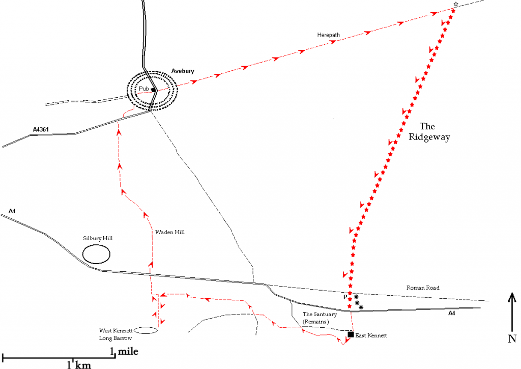
Route: Red Lion, Avebury – Overton Hill – Sanctuary – West Kennett Long Barrow – Silbury Hill – Red Lion, Avebury.
Length: 5 miles
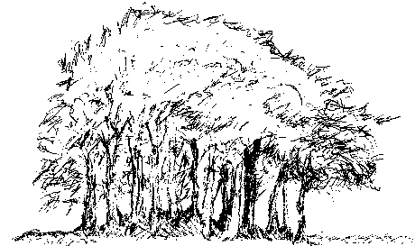
From the Red Lion pub (map ref. SU 1023 6982) cross the road between two hairpin bends and walk eastwards along the path marked as Green Street. The Red Lion stands at a staggered crossroads and inside is a well, said to date from 1600 A.D., though it was almost certainly dug much earlier. Green Street, once a major route from Marlborough to Bath, is now a wide grassy track running between fields and through a farm which joins up with the Ridgeway. In just over half a mile you will see a tree clump on the right which is on top of a barrow, situated just where you need to turn right. Before you walk on, go up the barrow and see if any offerings are laid out beneath the trees. It is hard not to feel drawn towards this little copse guarding its barrow, so it is no surprise if it is treated as a modern sacred grove.
Barrow on ‘Green Street’
The barrow is entirely overshadowed by the trees but the copse makes a highly visible landmark. Copses on the Ridgeway are often called ‘hedgehogs’ for obvious reasons. Green Street is also called ‘Herepath’. We are told that this means a military path because heer in German means army but since the nearby A4 is much more suitable for an army, running straight to Mildenhall (the Roman Cunetio), the herepath probably just signals a toll-free route for locals. In any event, the Green Street appellation indicates an ancient drovers’ route.
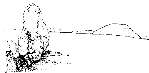
From this barrow beneath the copse, follow the path southwards for a little over a mile until it joins the Ridgeway at Overton Hill where you turn right and go downhill past a row of far more conspicuous barrows on the brow of the hill to the left and the public car park on the right. Cross the A4 dual carriageway and almost immediately you will see a gate on your right giving access to the Sanctuary. The Sanctuary henge would have been easily visible from Overton Hill but now there are only concrete posts to represent the missing stones. By the gate is a notice board giving details of what the site is supposed to have looked like. Beside the A4 and facing the Ridgeway where it comes down the slope of Overton Hill, the Sanctuary is in a perfect position for directing travellers approaching Avebury. It is reminiscent of medieval toll-houses, also often circular and looking out in several directions, posted at the entrances to high streets. Take the time to work out if and how this spot fits in with its surroundings and you will realise how prominent certain features are, in particular that V-shaped cleft on the horizon to the south, marking the location of West Kennett long barrow.
West Kennett from a distance
The cleft marking the barrow’s position is easily visible on the otherwise level horizon (looking south from the Sanctuary beside the A4).
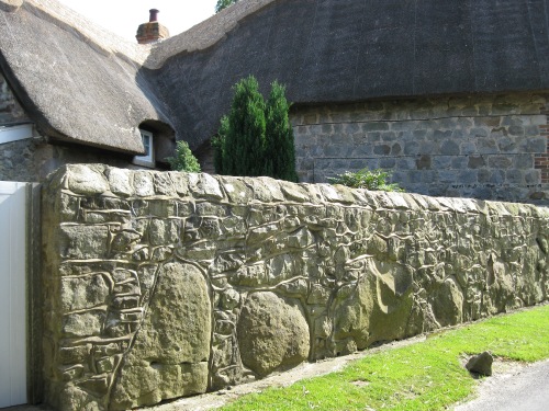
Leave the Sanctuary via the gate and continue going south along the footpath; within a short distance the narrow path becomes a lane. Notice the stone walls in front of the houses on the left as you pass; embedded in the base are the outlines of roughly shaped boulders, probably taken from Avebury.
Sarsen stones in wall
It is only to be expected that local materials, mainly sarsen stone and flint, should be used for building. However, the large sarsen boulders in the wall in the photograph are clearly different from the rest and were presumably part of the Avebury complex originally. Factoring in these “lost” stones gives an impression of just how big and complex Avebury must have been in its heyday.
Where the lane ends turn sharp right and walk for quarter of a mile along a metalled road through the quiet village of East Kennett. On the grass in front of a house on the left is a sarsen boulder perhaps also from Avebury. When you draw level with a disused pumping station (as its name suggests, the village is on the River Kennet), turn left onto a footpath crossing a field beside a line of trees. Almost immediately turn sharp right onto a narrow path cutting through farmland and across a minor road for about three quarters of a mile until it meets the path for West Kennett long barrow, an obvious landmark. Turn left and walk the short distance to the stones jutting up on the horizon which mark the entrance to the barrow. The barrow is spacious inside, high enough to stand without stooping. It is known to have been used as a burial chamber as numbers of bones were discovered, though since the bones are of a much later date the assumption must be that the barrow was not originally built for burial purposes. Your arrival may coincide with a group chant since the site attracts coachloads of visitors many of them latter-day pilgrims rather than tourists but while waiting, should you elect not to join in, you can examine the exterior and the view. If you walk along the top of the barrow to the western end you will be in a direct line-of-sight with Windmill Hill; you can also look eastwards across to a church spire and decide if it is there by chance or an after-echo of a ley marker.
West Kennett (map ref: SU 104677)
Silbury Hill is in line-of-sight with the entrance of West Kennett. Since, despite its size, Silbury Hill is not visible from everywhere and the surrounding ‘bowl’ is engineered space, this is presumably intended.
From West Kennett go back down the path and cross over the A4. On the other side is a kissing gate and ahead on the left you will see Silbury Hill. Surprisingly for such an enormous mound, described as the largest earthwork in Europe, Silbury is not much of a landmark. It is unmissable of course at close quarters and from the vantage point of Overton Hill but it does not have the characteristics of a ‘beacon’.
As you pass Silbury Hill on the left you will notice the long ridge of Waden Hill looming on the right. One cannot help noticing that it forms an unusually flat horizon and it is claimed that when walking down the Overton Hill section of the Ridgeway you can see the top of Silbury Hill ‘riding’ along the top of Waden Hill. There is a trig point on Waden Hill from where you get a view of the downs beyond Avebury stretching away to Milk and Tan hills. From Silbury Hill the path carries on straight to Avebury village centre and the Red Lion pub.
That is the end of the walk itself but for those interested in aligning features on the landscape, here’s an experiment. Make for the West Kennett long barrow, by car if you prefer, the nearest parking is in a lay-by on the A4 from where you will see the footpath to the barrow. Walk along the length of the barrow to its western end and draw a mental line from where you are standing to the horizon which is bounded by Windmill Hill: the line should pass exactly through the centre of Silbury Hill. You can also try this sighting from the top of Windmill Hill looking towards West Kennett via Silbury Hill. At all times during this walk, indeed at all times during all the walks, it is worth keeping a look-out for such alignments. Discovering one of your very own is a thrilling moment even if on later reflection you decide it was probably a coincidence arising from wishful enthusiasm.


Leave a Reply